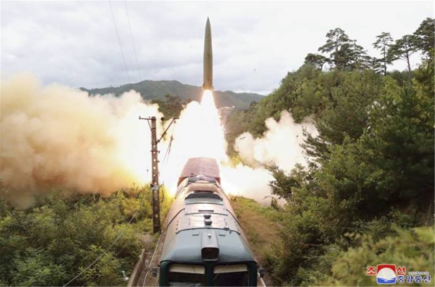
North Korean Weapon Development
North Korea has recently conducted their fifth successful test of an ICBM. As North Korean leadership continues to move the country towards military standby, collecting intelligence becomes crucial in determining the level and extent of North Korea as a threat.
Satellite imagery has proven to be the most effective method of gathering information on North Korean bases, launch sites, and training areas. With growing North Korean military proficiency, finding opportunities to obtain satellite photos of relevant North Korean assets is paramount. Additionally, software which can identify or forecast active satellites orbiting over specific regions at a given time could potentially save time and resources.
Satellite Image Forecasting
As satellite image capability in North Korea becomes increasingly relevant, software-based image forecasting helps interested parties effectively communicate with satellite operators and more quickly acquire satellite services. Forecasting services using satellite databases like AGI can also evaluate camera coverage by monitoring the position and orientation of certain spacecraft.
Missile Defense Simulation Software
As information continues to surface regarding the capabilities of North Korean missiles, it is important for vulnerable territories to assess their missile defense coverage. Simulation software allows organizations to observe how well their defense systems can counter the performance of North Korean missiles. Running tests in a representative simulated environment also reduces spending on training exercises and replacement missiles.
Advantages of Software Image Forecasting
- Data: Satellite image forecasting software provides important, detailed information on different spacecraft by accessing records in reference databases.
- Convenience: Image forecasting software streamlines the process of identifying and contacting providers with satellites in desired orbital positions.
- Configurability: Reference databases can be modified to include native satellite data.
To summarize, the growing threat of North Korean missiles requires greater intelligence collection regarding the country’s military assets. Satellite image forecasting software helps identify satellites in desired orbital positions, effectively connecting intelligence groups and organizations with satellite services. Additionally, missile defense simulation software enables users to assess defensive capabilities against North Korean missile threats.